
Application Description
Monitor hurricanes, typhoons, and cyclones worldwide in real-time with Zoom Earth.
Zoom Earth provides an interactive global weather map and a real-time hurricane tracker. Key features include satellite imagery, rain radar, weather forecasts, hurricane and wildfire tracking, and extensive customization options.
[Key Features]
-
Satellite Imagery: View near real-time weather maps using satellite data from NOAA GOES, JMA Himawari, EUMETSAT Meteosat, and NASA's Aqua and Terra satellites.
-
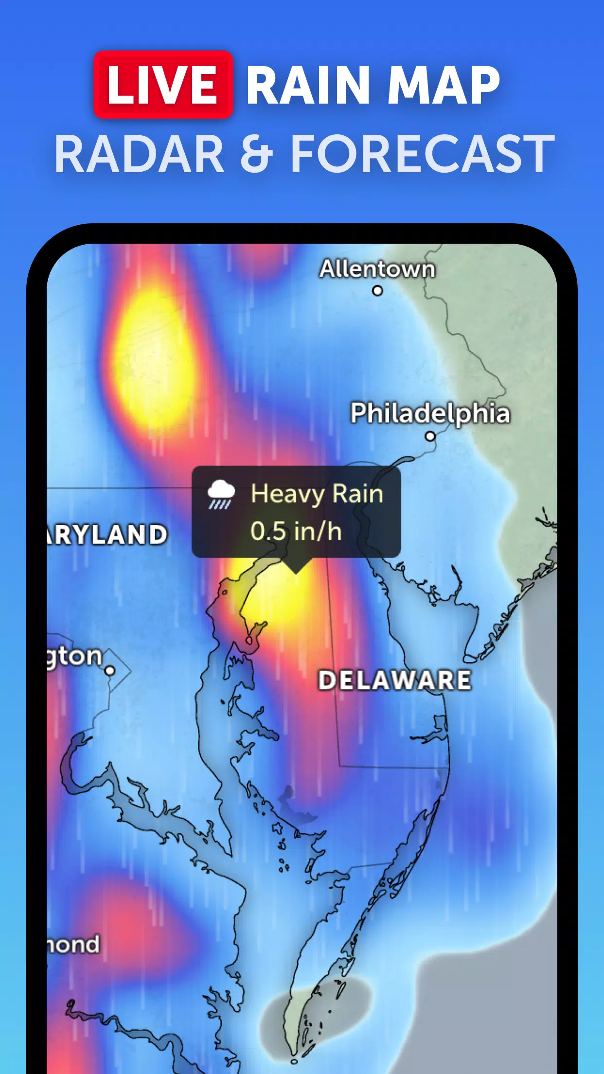
Rain Radar: Track rain and snow in real-time with our weather radar map, utilizing ground-based Doppler radar data.
-
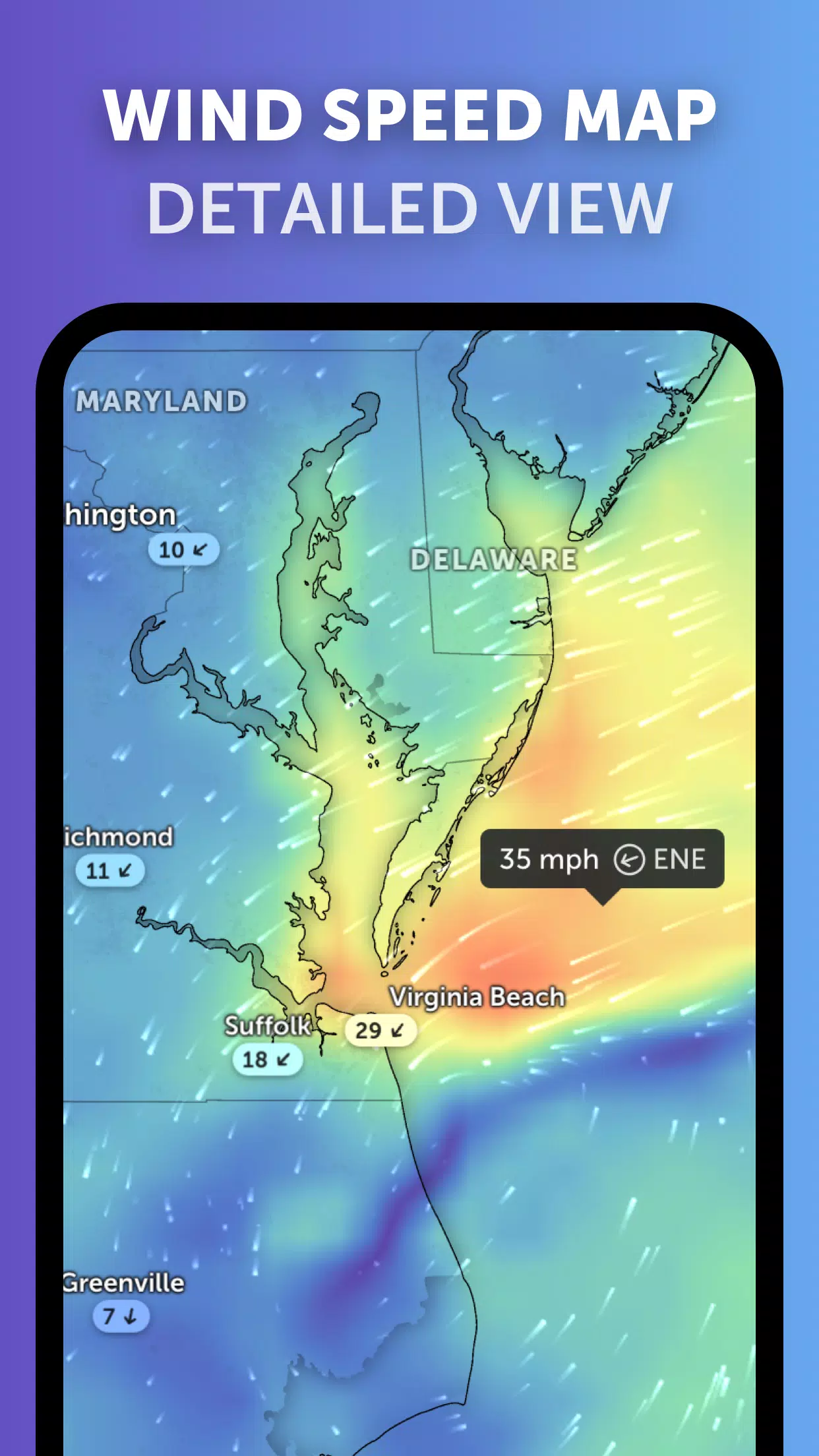
Weather Forecast Maps: Explore interactive weather visualizations, including precipitation, wind speed and gusts, temperature, "feels like" temperature, humidity, dew point, and atmospheric pressure.
-
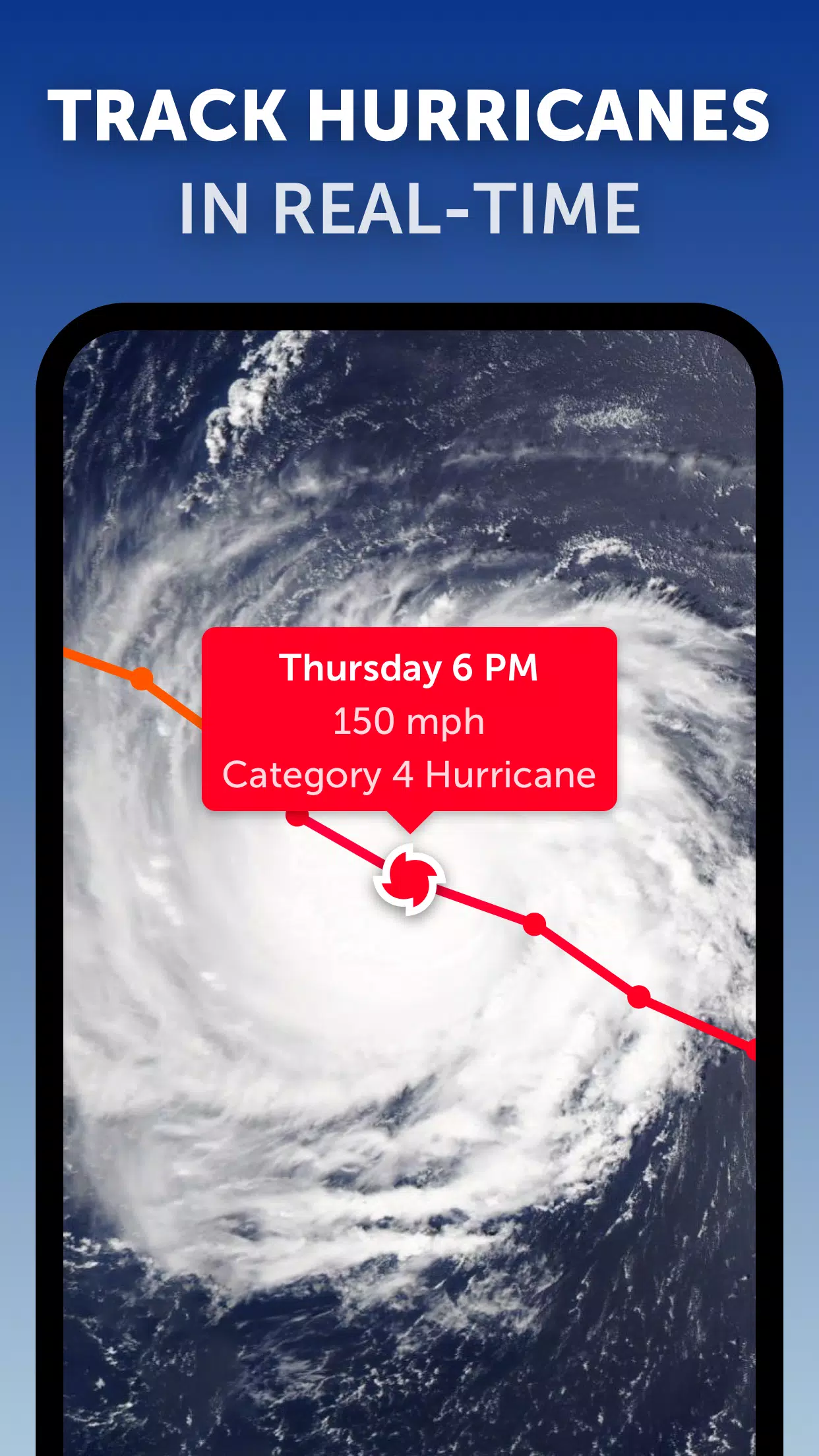
Hurricane Tracking: Follow hurricanes, from formation to category 5, using real-time data from NHC, JTWC, NRL, and IBTrACS.
-
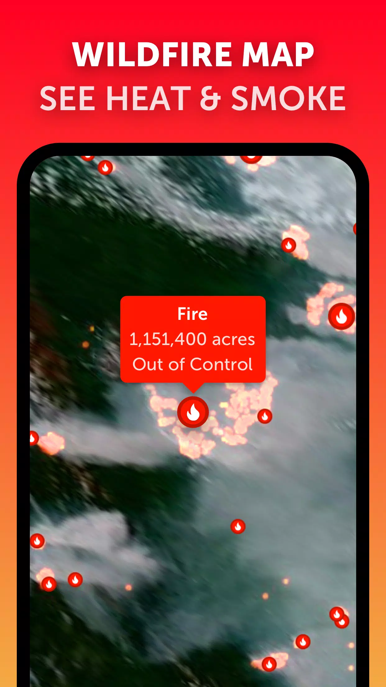
Wildfire Tracking: Monitor active wildfires and heat spots using daily updates from NASA FIRMS satellite data.
-
Customization: Personalize your experience by adjusting temperature and wind units, time zone, animation styles, and more.
Zoom Earth Version 3.1 Updates (September 19, 2024)
- Improved clarity when tracking multiple tropical systems.
- Separate alerts for Atlantic and Eastern Pacific storms.
- Enhanced map labeling.
Screenshot
Reviews
Post Comments
Latest Articles
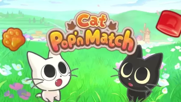
Ash & Snow Launches Cat Pop'n Match Game
The mobile market is no stranger to match-3 games. Yet, a compelling premise paired with a generous dose of charm is always worth a look. I'm happy to report that Ash & Snow: Cat Pop'n Match fits that description perfectly.What Is Ash & Snow: Cat Pop
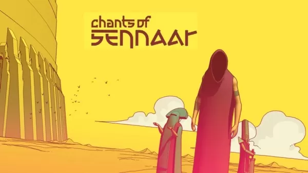
Chants of Sennaar: Decode Tongues in Babel's Tower
Chants of Sennaar is now available on mobile devices! Created by Rundisc and released on mobile by Playdigious, the game takes cues from titles like Heaven’s Vault and Captain Blood. It originally launched in September 2023 for Nintendo Switch, PlayS
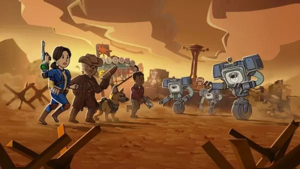
Fallout Shelter Rolls Out Seasons, the Debut Season Being Viva New Vegas!
Bethesda Softworks has introduced a new feature for Fallout Shelter called Seasons. In its first season, Fallout Shelter brings you Viva New Vegas — the same world featured in the second season of Amazon Prime’s Fallout TV series.
Viva New Vegas mark
How Long is Death Stranding 2?
Death Stranding 2: On the Beach is now out on PS5, offering a vast trek across Australia as Sam Porter Bridges works to link the continent to the Chiral Network. But how long does it actually take? We’ll break down exactly how many hours different IG
Persona 4 Release Officially Confirmed at Xbox Event
After months of speculation and leaks, Atlus has officially confirmed the development of a Persona 4 remake.PlayA short reveal trailer gave us our first glimpse of Persona 4 Revival, coming to Xbox, PS5, and PC. It will be available on Game Pass from

Rail Rescue: Fun and Challenging Puzzles Coming Soon
Rail Rescue: Puzzle Lines is set to launch on mobile devices on June 30th Featuring 500 levels at release, players must draw rail lines to save adorable cartoon characters Rebuild your town and engage with unique residents to uncover their personal stories and hidden secrets It’s fascinating to s
Apps like Zoom Earth

Meteoprog - Weather forecast
Weather丨28.0 MB
Rain Today
Weather丨97.3 MB

Rome Weather Forecast
Weather丨28.4 MB

Buienradar
Weather丨65.4 MB
WDTN Weather
Weather丨51.7 MB
Weatherzone
Weather丨92.6 MB

Latest Apps

Pixel Sketch
Art & Design丨53.2 MB
RubikCalc PRO
Tools丨25.00M


CT Fe Alves
Communication丨68.30M

Unfollow For Twitter
Tools丨6.40M

OnlineNet Manager
Tools丨106.10M

Go Dictation
Education丨38.3 MB

LG Mobile Switch
Tools丨5.30M

Trending Apps
MORE +


Top News
MORE +

01
03-28
Top Streaming Platforms for Live Sports in 2025
Gone are the days when watching sports was as simple as turning on your TV and tuning into the big game. Today, the landscape of sports streaming has become a complex web of regional blackouts, paywalls, and exclusive rights that can leave fans feeling lost. With numerous streaming services vying fo
02
12-25
Vienna Opera Delight: Reverse 1.99 Update
Reverse: 1999 Version 1.7 Update: A Viennese Adventure Awaits!
Bluepoch Games' Reverse: 1999 is taking players on a trip back in time with its latest update, Version 1.7, launching players into the captivating world of early 20th-century Vienna in the new "E Lucevan Le Stelle" event. This update del
03
11-13
Black Myth: Wukong Review Impresses Amid Guideline Debate
After four long years of waiting since its first announcement in 2020, the verdict is in for Black Myth: Wukong! Read more to learn more about the details and what other reviewers thought about the game.Black Myth: Wukong Is Almost HereBut Only On PCEver since its first trailer back in 2020, Black M
04
01-23
“Descenders” Codes Unlock January 2025 Content
Descenders: A Thrilling Bike Racing Game with Active Codes!
Descenders delivers exhilarating bike racing action and boasts impressive reviews. Explore diverse locations, perform daring stunts, and choose from a wide variety of bikes and gear. Realistic bike physics make riding and pulling off tric
05
02-02
Roblox Grace Commands Guide Released
Grace Roblox Game Commands: A Comprehensive Guide
Grace is a challenging Roblox experience featuring terrifying entities and demanding levels. To aid players, especially during testing, a set of in-game commands is available on test servers. This guide details all commands and their usage.
All Grac