
Application Description
Are you ready? Jacksonville, FL's JaxReady is your essential tool for preparing for natural disasters.
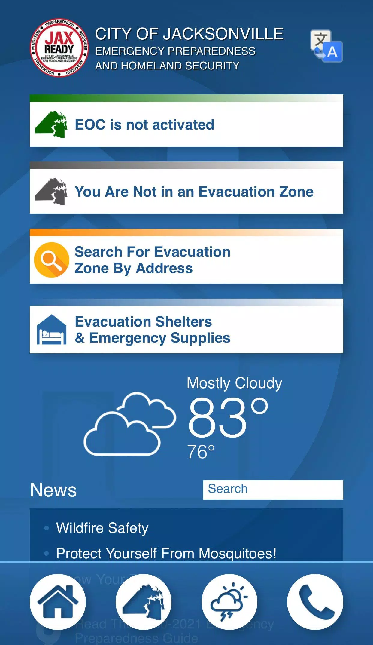
JaxReady, brought to you by the Emergency Preparedness Division and Information Technologies Division of the City of Jacksonville, Florida, equips you with the resources to monitor weather threats and plan for evacuation during a natural disaster. With JaxReady, you gain access to real-time threat levels, detailed weather reports, and crucial wildfire updates, along with the latest news feeds for emergency preparedness and evacuation.
Features:
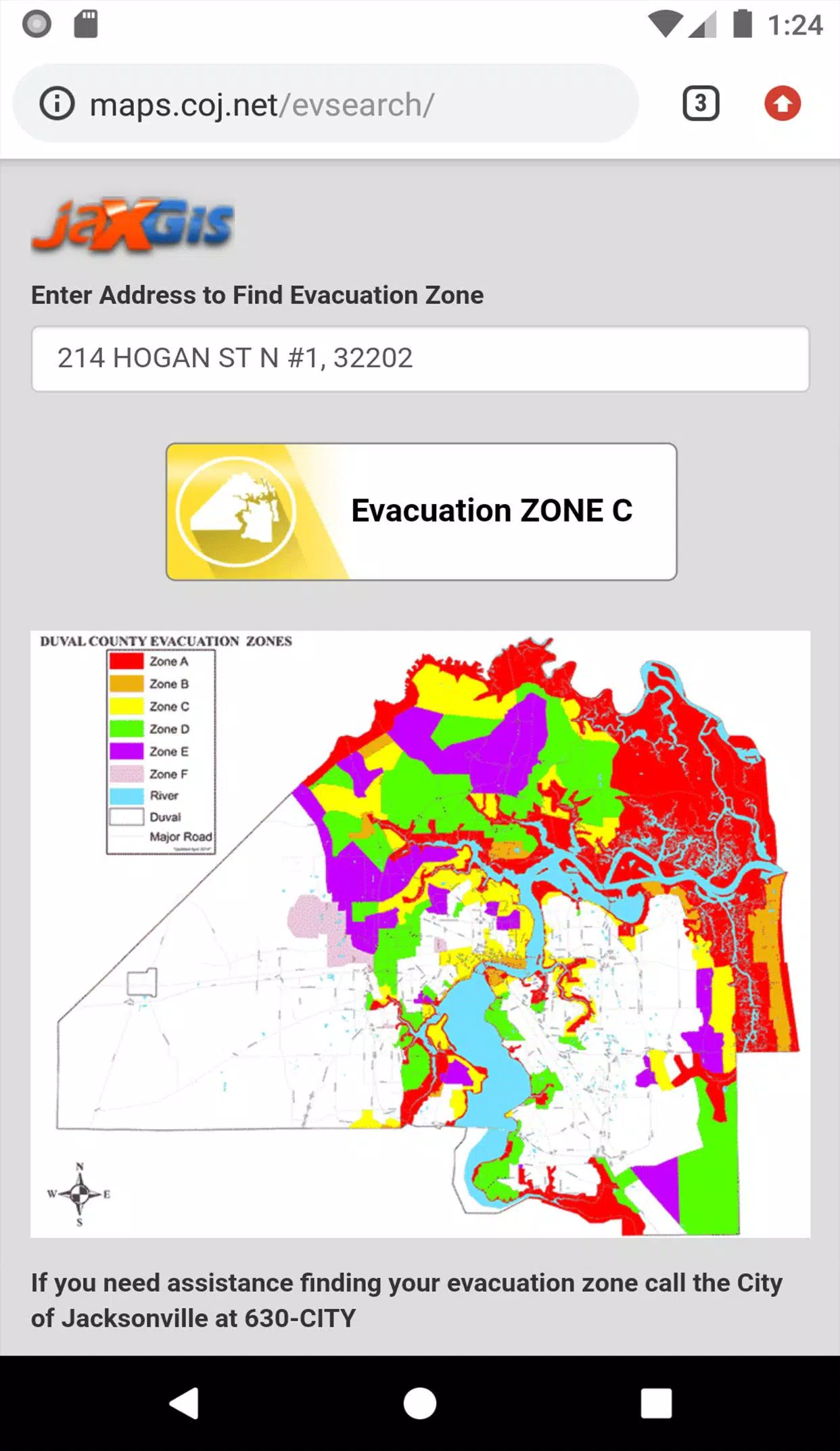
GPS Functionality: Easily locate your designated Evacuation Zone with integrated GPS technology.
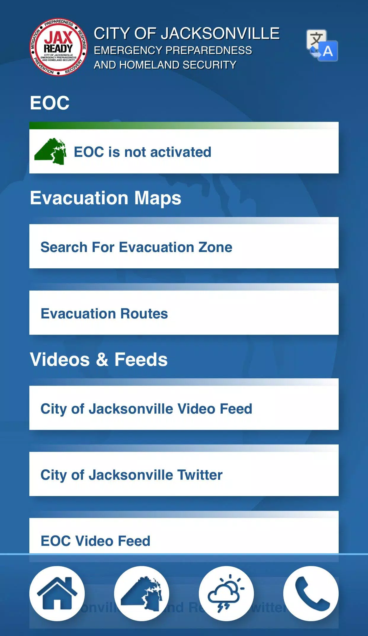
Real-Time Alerts: Stay informed with the current Emergency Operations Center (EOC) Activation Level, Weather Threat Level, and Fire Danger Index, all tailored to your specific geolocation.
Special Needs Support: Access links to special needs registration to ensure those with medical requirements are taken care of during an evacuation.
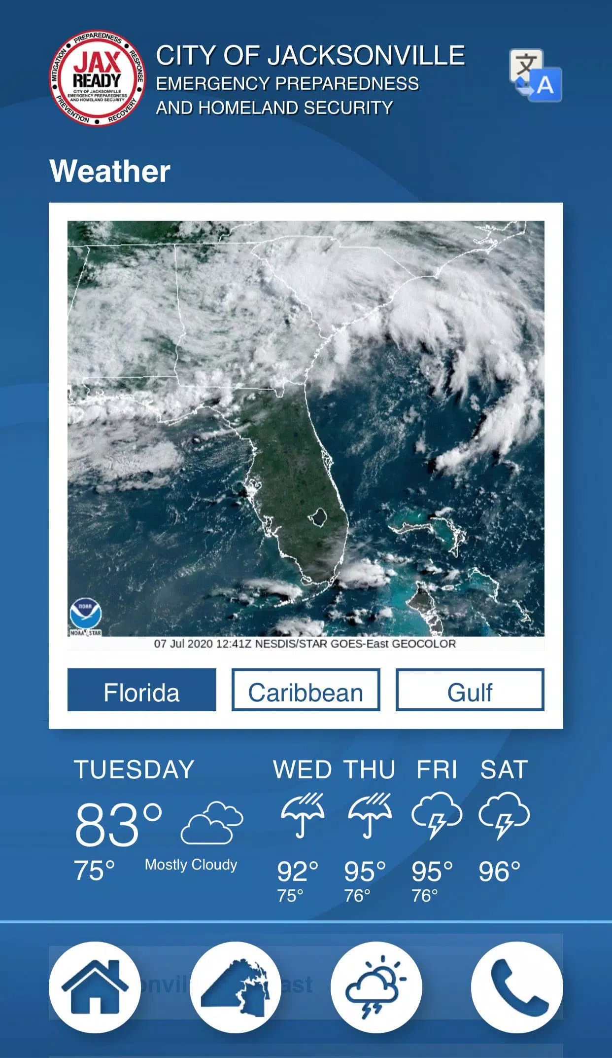
Comprehensive Updates: Receive the latest weather and fire news to stay ahead of potential dangers.
Visual Maps: Utilize weather, wildfire, and drought index maps to better understand and prepare for the conditions around you.
Screenshot
Reviews
Post Comments
Latest Articles

"Eighth Era Unveils New PvP Mode in Update"
If you're a fan of competitive gaming, you'll be thrilled to know that developer Nice Gang is enhancing their squad-based RPG, Eighth Era, with an exciting new PvP feature. With the official launch, Eighth Era now includes an Arena mode that lets you battle other players once you hit level 9. This a
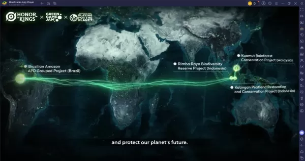
Honor of Kings: Guide to the Protect Nature Event
Honor of Kings, the world's most popular mobile MOBA, has introduced its eco-themed update with the "Protect Nature, Protect All Life" event, launching on April 3. This event aligns with the Green Game Jam 2025 initiative by Playing for the Planet and will run until April 22. It presents an exciting
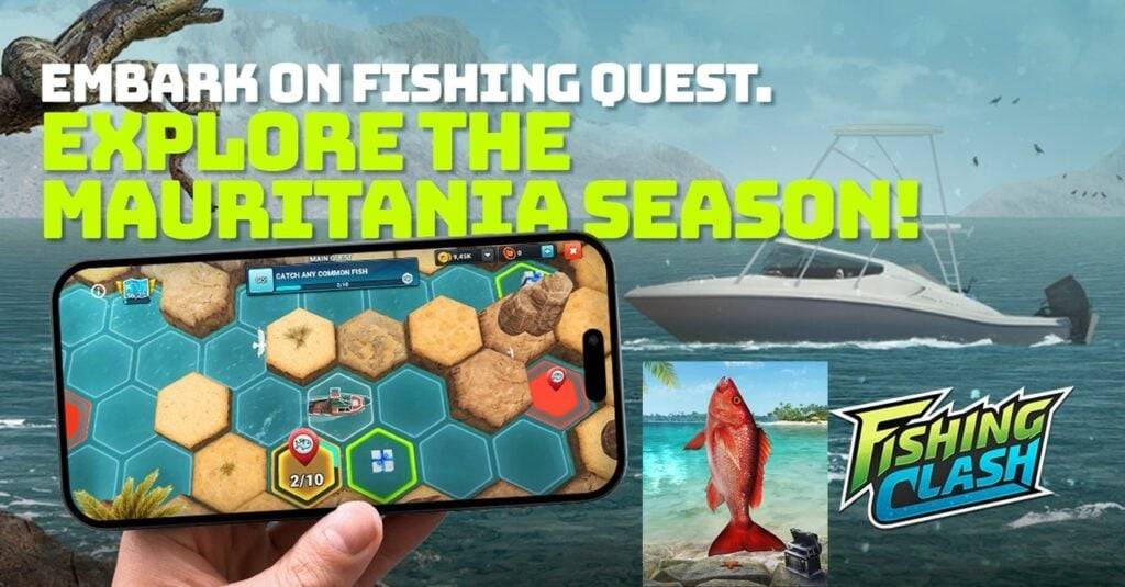
Fishing Clash Unveils Mauritanian Seasons, Quests, and Fisheries
Fishing Clash is revolutionizing its gameplay with the introduction of a new seasonal system, starting today with the exciting Mauritania location. This update not only brings a fresh fishery to explore but also introduces structured competition and the engaging Fishing Quest event, transforming the
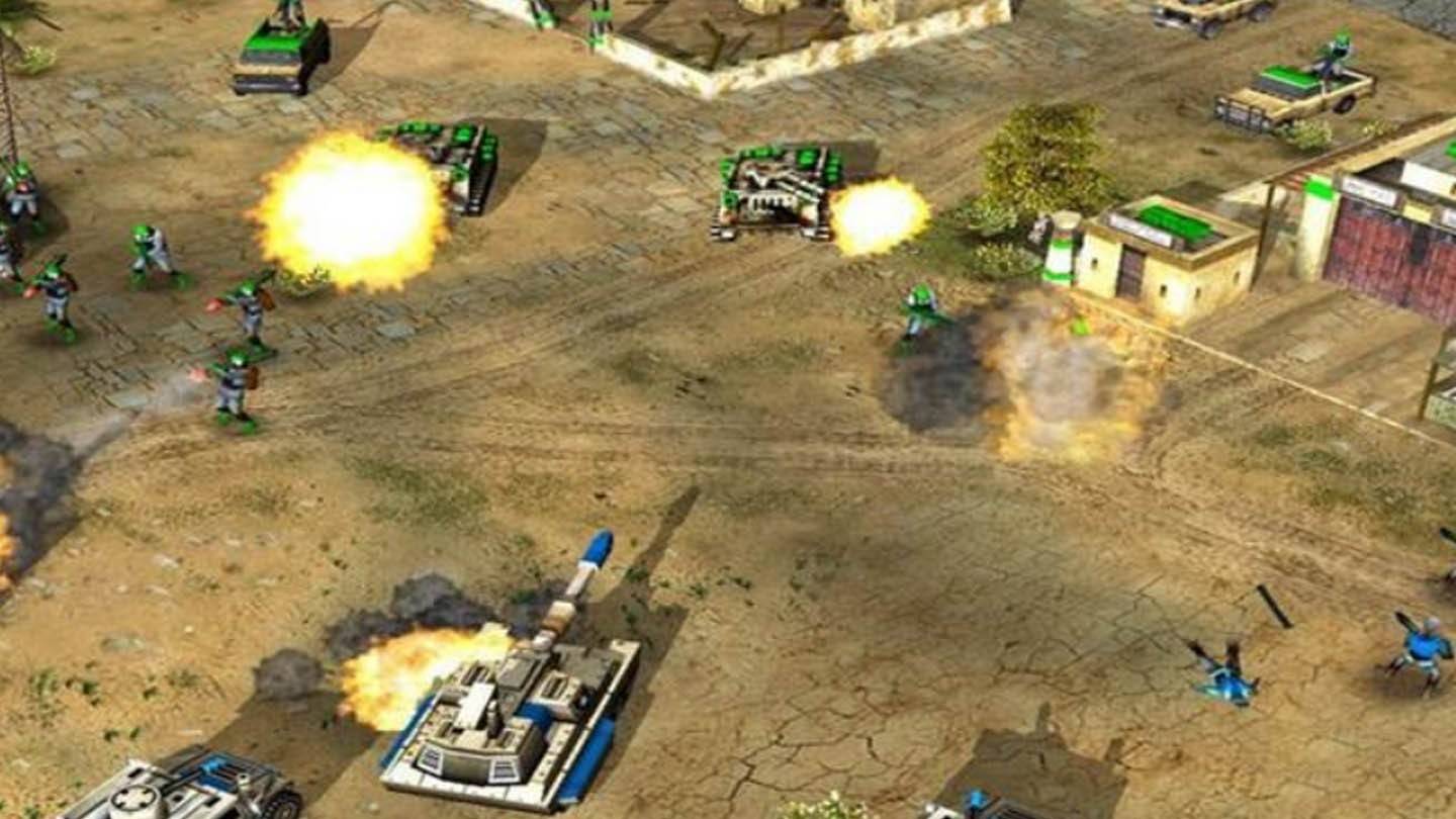
EA Releases Source Code for Four C&C Games
Electronic Arts has taken a bold step by releasing the source code for four iconic titles in the Command & Conquer series. These games—Command & Conquer, Command & Conquer: Red Alert, Command & Conquer: Renegade, and Command & Conquer: Generals—are now freely available on GitHub under an open licens
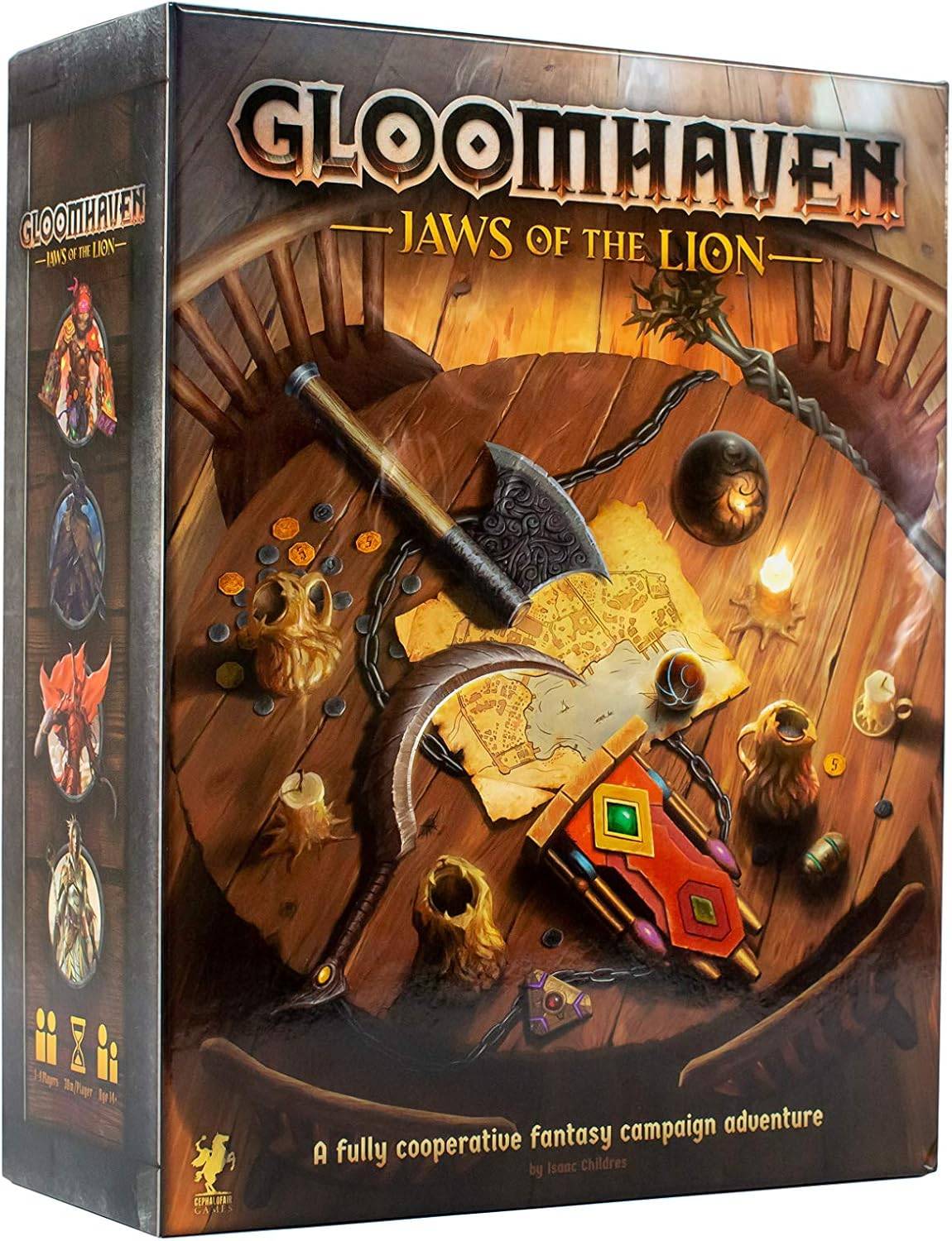
Top RPG Board Games to Play in 2025
If you're looking for an engaging and immersive gaming experience, modern board games offer a thrilling escape into worlds of strategy, exploration, and adventure. For those who find traditional strategy games a bit dry, role-playing board games (RPGs) provide a perfect blend of narrative depth and
Next-Gen Xbox Launch Slated for 2027, Handheld in 2025
A recent report has shed light on Microsoft's ambitious plans for its video game hardware, revealing that a next-generation Xbox is slated for release in 2027, accompanied by an Xbox-branded gaming handheld expected to launch in late 2025. According to Windows Central, a partner PC gaming handheld c
Apps like JaxReady
Rain Today
Weather丨97.3 MB

Rome Weather Forecast
Weather丨28.4 MB

Buienradar
Weather丨65.4 MB
WDTN Weather
Weather丨51.7 MB

Weatherzone
Weather丨92.6 MB


Aurora Watch (UK)
Weather丨3.6 MB
Latest Apps


MTA Companion
Travel & Local丨4.2 MB

Otithee
Travel & Local丨36.8 MB

STARNow
Travel & Local丨79.2 MB

FITUP ENTRENO
Lifestyle丨31.20M


The Beat 2
Art & Design丨92.9 MB

Cardiff Bus
Travel & Local丨61.0 MB
Trending Apps
MORE +


Top News
MORE +


01
11-14
Dead by Daylight is Officially Adding Lara Croft
Lara Croft is officially coming to Dead by Daylight, Behaviour Interactive has announced. It had long been speculated that Tomb Raider's protagonist would be joining Dead by Daylight's Survivor roster soon, but Behaviour has now put the rumors to rest. Just over a month after the release of
02
12-11
Disney Mirrorverse Ends Service This Year
Disney Mirrorverse, the mobile game that brought together an epic mashup of Disney and Pixar characters in a brand-new universe, has announced its EOS. Kabam, the company behind the game, just announced that they’ll be pulling the plug on December 16th, 2024.As of today, the game has already been pu
03
12-25
Vienna Opera Delight: Reverse 1.99 Update
Reverse: 1999 Version 1.7 Update: A Viennese Adventure Awaits!
Bluepoch Games' Reverse: 1999 is taking players on a trip back in time with its latest update, Version 1.7, launching players into the captivating world of early 20th-century Vienna in the new "E Lucevan Le Stelle" event. This update del
04
12-11
Pokémon GO Celebrates 8 Years with Exciting Raids and Bonuses!
Pokémon GO is celebrating its 8th anniversary with a week-long extravaganza! The festivities begin Friday, June 28th, at 10:00 a.m. and conclude Wednesday, July 3rd, at 8:00 p.m. Get ready for exciting new Pokémon debuts, boosted event bonuses, and enhanced raid and trading opportunities.
Here's a
05
11-16
Krafton's Gamescom lineup to feature Dark & Darker Mobile, Inzoi and PUBG
Game developer Krafton has unveiled its upcoming Gamescom 2024 lineup!Check out what's going to be featured on the show floorInzoi, Dark & Darker Mobile and PUBG will all be representedGamescom 2024 is right around the corner, and it's one of the most-visited consumer gaming shows on the planet. Com
Topics
More +